The story of London’s hidden River Fleet is as long and winding as the city that’s built over it.
Did you know London used to have more than one major river? Major rivers that have long since been covered up and lost. Well, almost. A few people are still eagerly hunting out these hidden bits of London history, and we’re some of them.
The most famous is the river Fleet – once a mighty waterway to rival perhaps even the Thames, now a trickle of water in a storm drain that runs under the city, but the story of it’s transformation gives us flashes of London history that paint a vivid picture of how our home has evolved
Curious? Here’s everything you need to know about the Fleet River.
What’s the Fuss About the River Fleet?
If you, like us, are London history enthusiasts, you’ll get pretty worked up by the Fleet River for a whole bunch of reasons.
Obviously, there’s the fact that it’s hidden – nothing creates a stir like a bit of mystery. But it’s when you start to learn about the history of the Fleet River that its hidden waters take on even more of a buzz.
The history of the Fleet River blazes a trail right through some of the biggest moments in London’s story, from Roman battles with Britanic warriors, to a cess-filled breeder of mediaeval disease, with a stop at the Great Fire and the building of a modern city that we can recognise today
Where to begin?
The History of the River Fleet
Headwaters
The River Fleet started its life well before London, as a tidal river that ran from north to south and had its mouth on the Thames. To the people that settled the area on the banks of the Thames, the Fleet would have been another key waterway in its own right, several hundred feet wide.
If you want to get technical, the Fleet gets its name from the Anglo Saxon word flēot which means an estuary, inlet, or bay. The Anglo Saxons came to England from 400 AD onwards settling these parts, bringing language and culture with them, but the river has a tale that stretches back hundreds of years before that.
Archaeologists have reasonable evidence to suggest that an important battle in Ancient British history took place at King’s Cross in 60 AD between the Romans and the Britons – the battle where Boudica died.
The site of the battle would have been open countryside – an ideal space for a scrap – on the land that is now King’s Cross. In fact, before King’s Cross was renamed King’s Cross in 1830, it was called Battle Bridge.
It’s estimated 80,000 Britons are said to have been slaughtered there, the nail in the coffin for any Britons hoping to stand up to Roman rule. Rumour has it that Queen Boudica is buried under platform number 10 at King’s Cross Station.
The Banks and the Channel
Continue down the winding course of history to about the middle ages and London has grown considerably. Farringdon, once fields and peaceful riverbank swimming spots, is now part of a wider, built-up metropolis of roughly 45,000 people.
Is it fair to say that people in the middle ages weren’t so environmentally conscious? Probably. They had begun dumping human and animal waste into the Fleet, as well as other undesirable stuff… the body of your rival, the leftovers of granny’s gruel, the puppy it turns out you really only wanted for Christmas.
One of the largest polluters was Smithfield Market (that’s still about today, 800 years later). Word has it that the streets around the Fleet would “run red with blood” on market day. They’d chuck animal carcasses, blood and guts into the river. By about 1400 the Fleet river was so full of waste that it was little more than a ditch.
No wonder they wanted to cover it up.
The Mouth
Then along comes the Great Fire of London and burns everything to the ground, Christopher Wren hot on its tails to redesign the city. He saw the catastrophe as something of an opportunity and wanted to clean the lower reaches of the Fleet up, turning it into something like Venice’s Grand Canal – a waterway London could be proud of.
The river was widened to 40 ft across, proper banks were added, as were bridges at Bridewell, Fleet Street, Fleet Lane, and Holborn. The sections at what is now Blackfriars became wharves for unloaded ships, primarily of coal, and for a while it looked like it might be a roaring success…
But they couldn’t stop the darn up-streamers from chucking their detritus in the river, and the canal became clogged up.
By the early 1700s voices were calling for the river to be covered over, in part because several people had fallen in and suffocated in the mud. Not a nice way to go considering the Fleet was being described as nothing more than an open sewer.
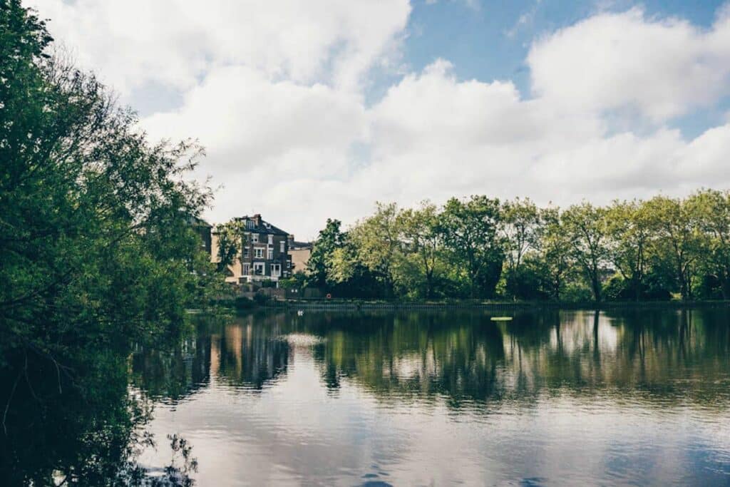
In 1732 work began and the Fleet river starts to take on the form we know it in today: subterranean. A few years earlier the river’s sources in Hampstead had been dammed to create the ponds you can swim in today.
By 1870 the only visible remnants of the Fleet River were on road signs, Fleet Street, Old Fleet Lane, Watergate, Fleet Road, and at its mouth on the Thames, through a small hole under what is now Blackfriars Bridge, visible only at low tide.
In present-day London, it can still be sought out if you know where to look.
Where to See the River Fleet Today
Fair warning here, a couple of these points involve staring down a drain on a busy street so you best leave your pride at home you dedicated river hunter, you.
A less embarrassing, and more scenic place to see the river is at its headwaters in Hampstead. The Fleet River is actually a runoff from the Vale of the Heath, and Highgate Swimming ponds on Hampstead Heath. You can follow the stream along from the ponds until it goes underground at the appropriately-named Fleet Road.
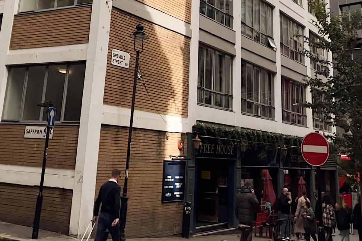
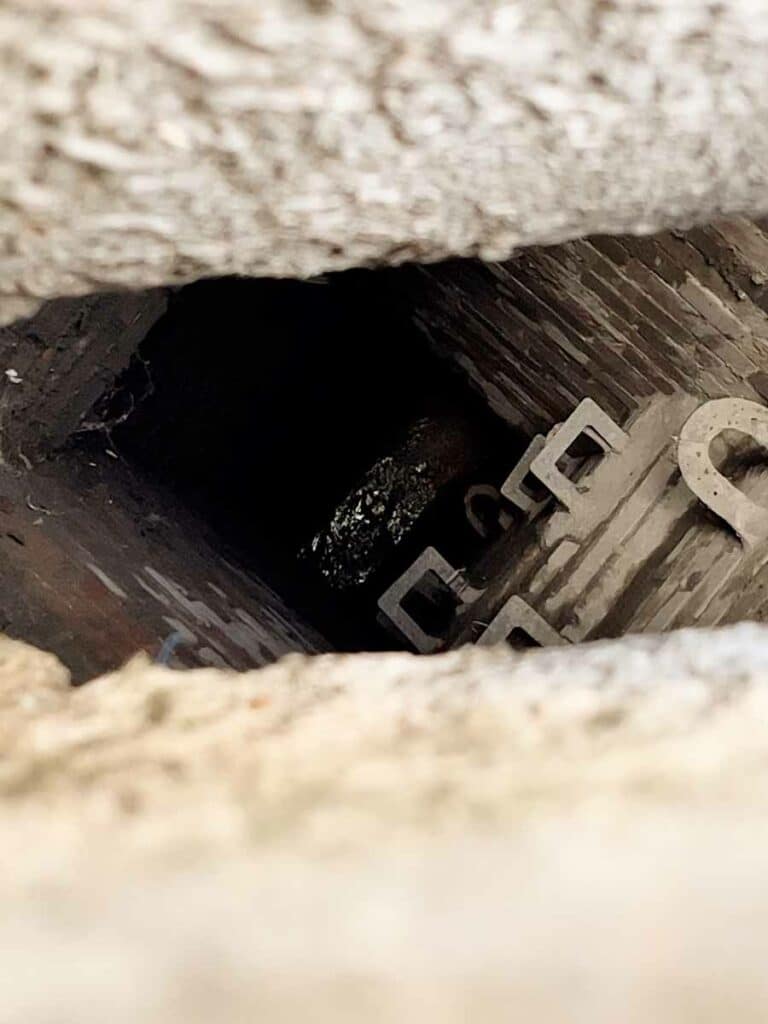
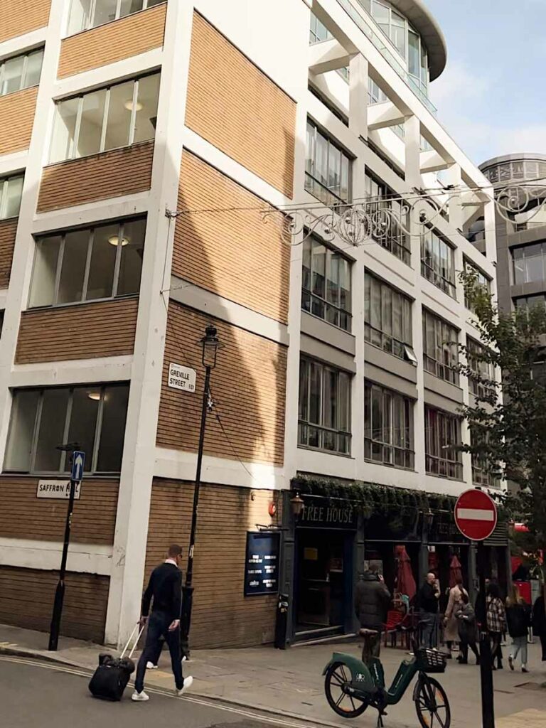
After that it basically disappears. Flowing towards King’s Cross and down through Farringdon. That’s where you can see it through drains, once outside the Coach and Horses pub on Ray Street in Farringdon, and again on the intersection of Saffron Hill and Grenville Street.
Actually, from here, a walk down Farringdon Street will take you pretty much right along the course of the river, it flowing right underneath your feet. Until you reach Blackfriars Bridge where you can see it trickling into the Thames when the tide is low.
Fleet River: Practical Tips
The nearest tube stops for the above locations are as follows:
- For the Hampstead Heath ponds – Hampstead station (of course).
- For the drainage points, your best bet is to get off at Farringdon and walk south. Alternatively, you could get off at Blackfriars and walk north, starting at the mouth of the river and heading up towards Grenville Road.
Fleet River: Map
Check out this handy map of the River Fleet.