Thirteen waymarked trails, more than a million trees, and one route with seventeen hand-carved characters hidden along it. Here is how to walk Epping Forest properly, whichever end you come in from.
Sprawling over 2,400 hectares, Epping Forest is a walker’s adventure playground within easy reach of London. It starts in Forest Gate and stretches all the way to Epping in Essex, so it is little wonder it has become the go-to sanctuary for anyone wanting to blow the cobwebs off with a good old ramble. It is comfortably the biggest of London’s forests, and it is not close.
The numbers are absurd once you look at them. The City of London Corporation, which has run the place since the Epping Forest Act of 1878, counts over a million trees, 50,000 ancient pollards, some of them getting on for a thousand years old, and more than ten million visits a year. In 2024 it put a value on all that of £1.9 billion over fifty years, which works out at a return of roughly twenty to one on what it costs to look after.
We have written before about the forest in our guide to the best walks in London, but with any area this large there is far more to explore than one entry can carry. If you want the routes mapped out for you elsewhere in the city, our self-guided London walks collection does the same job for other neighbourhoods. There are thirteen waymarked trails worth walking here. The City signposts and publishes maps for nine of them; the other four are still there on the ground and still worth your time, and we have said so where the map has quietly disappeared.
Before you go

The single biggest change if you have not been for a while is that parking costs money. Thirty-eight of the forest car parks now charge: £1.75 for up to an hour, £3 for two, £4.50 for up to four and £7 for the day, with an annual permit at £170. Payment goes through RingGo, either the app or 020 7110 0000, and High Beach has pay-and-display machines that take card only. Motorbikes park free, and so do Blue Badge holders once they have registered with the forest.
Two things about that worth knowing before you arrive. Mobile signal in the car parks is patchy, so pay before you walk away rather than halfway down a trail, and do not scan any QR code you find in a forest car park. The City has put out its own warning about that: it does not use QR codes for parking and fraudulent ones have been found in the car parks.
Car parks used to stay open until 8pm and now close at 6.30pm, which is worth factoring into an autumn afternoon. Toilets are the other thing people get caught by. There are three, at the visitor centres in Chingford and High Beach and at the Temple in Wanstead Park, and they all run on visitor centre hours, so on a Monday when both centres are shut there are no public toilets in the forest at all.

Getting here by train is easy and cheap. The Weaver line runs from Liverpool Street to Chingford in about 26 minutes, four times an hour, and the forest edge at Chingford Plain is five to ten minutes’ walk from the station, depending on which City of London page you believe. The Central line covers the other side: Snaresbrook and Wanstead for the southern trails, Loughton and Theydon Bois for the north. Buses serve most entrances, but some routes thin out badly at weekends, so check before you rely on one.
One last thing, and it is the detail we like most. If you come across what looks like a fallen branch jammed across a stream, leave it where it is. There are 374 leaky dams going in across the forest’s ditches and streams, holding back around 10,000 cubic metres of water to protect 500-odd homes downstream, and the smaller ones look exactly like blockages. The work finishes in spring 2027.
And it gets very muddy. Proper boots, not trainers, from October onwards.
Chingford and Connaught Water
The easiest end to reach, the easiest walking, and the end to pick if you are bringing children or anyone who would rather not deal with a hill. All three trails here start within ten minutes of Chingford station.
Brambly Hedge trail
1.5 miles / 2.4km, from the Epping Forest Visitor Centre at Chingford
New for 2026 and the best thing to happen to the forest in years, particularly if you are walking with small people. Seventeen characters from Jill Barklem’s Brambly Hedge books have been hand-carved in oak and set along the Gloucester Ride between the Chingford visitor centre and Connaught Water, Primrose Woodmouse and Mrs Toadflax and Lord Woodmouse among them.
The detail that lifts it above the average sculpture trail is that every character’s name is carved in braille, with a tactile panel on the back of each one, so it works just as well for a child who cannot see the carvings as for one who can. Buy the trail map at the visitor centre before you set off, because the carvings are not signposted and half the pleasure is hunting for them. The Gloucester Ride is a gentle slope most of the way, with one short steep pull up to Connaught Water at the end, and finishing the whole thing earns a sticker, which the under-eights take extremely seriously.
Holly trail

2.5 miles / 4km, from Chingford Plain · Map
One of two walks in this guide starting from Chingford, the Holly Trail is a classic stroll through the forest, forging its way across Chingford Plain and then taking you through Bury Wood. Unlike some of the others here, this one is mostly under trees, with the exception of the section on the plain, and it is clearly signposted throughout, which makes it the one to pick if you would rather not think about navigation at all.
The City gives it an hour, on surfaced forest paths with short stretches across open grassland and one gentle incline. We walked it in November and the leaf cover was ankle deep, which is glorious and also means you have no idea what you are standing in. It gets genuinely boggy in the wetter months, so make sure you have got appropriate footwear rather than hoping for the best.
Willow trail
2.5 miles / 4km, from Connaught Water · Map
This one begins at Connaught Water, which is invariably ringed by anglers after a few hours of peace and quiet. Another mostly easy trail, it takes you across grassland and surfaced pathways, with one short but steep incline up to the lake from Chingford Plain.
Along the route you will see the willows the trail is named for, competing with their male and female catkins at the right time of year, and Grimston’s Oak, an oak pollard the City estimates at around 350 years old. Look out for the great crested grebe on the water. If you see one come off the water and shake its head, it is showing off to find a mate. Of the three Chingford trails this is the one we would do on a cold clear morning, when the light comes off the lake and the whole thing takes an hour.
Where to stop: the Royal Forest on Rangers Road, right beside the visitor centre and the Hunting Lodge, and about ten minutes from the station. Edmond Egan designed it in 1880 and it was renamed in 1882 after a royal visit; Heartwood took it over in December 2024, refurbished it and put four cask ales on, including East London Brewing’s Cowcatcher. If you want coffee and cake rather than a pint, the Larder at Butlers Retreat is next door, open 9am to 5pm daily with the kitchen shutting at three.
High Beach and Loughton
The hilly bit, and the most atmospheric. This is where the forest feels least like something on the edge of a city.
Beech trail

2.5 miles, from Pillow Mounds or High Beach
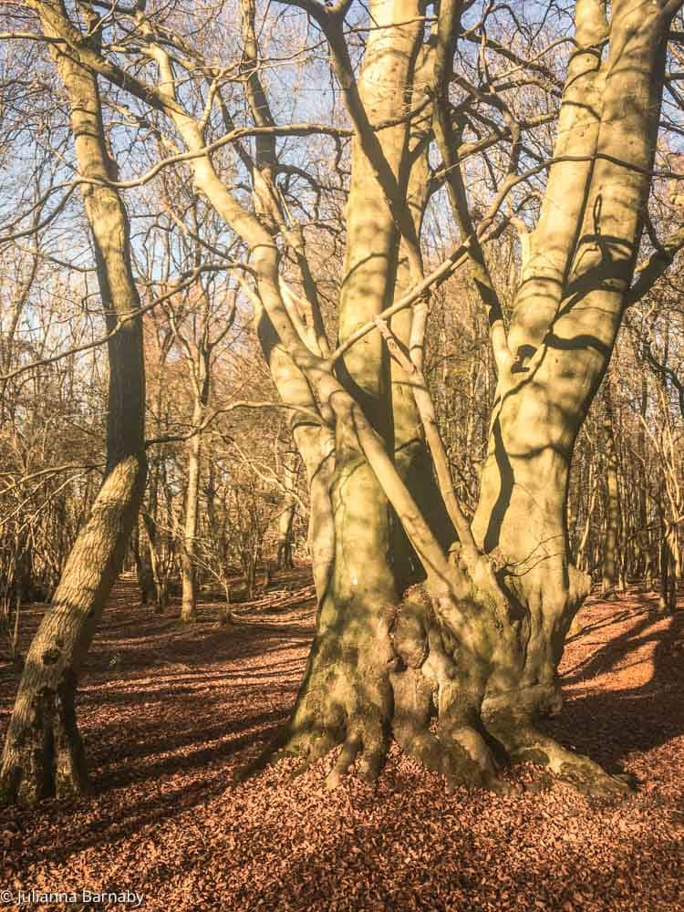
A pretty perambulation from the Pillow Mounds car park, and the one we have walked most. It takes you through a stretch of forest filled with the beeches it is named after and past the Iron Age earthwork at Loughton Camp, which the City reckons was built around 500 BC and which is a scheduled monument, so cycling and horse riding are both banned on it.
It is relatively uneven, so not the one to choose if all you want is a flat stroll, though there are only a couple of genuinely steep sections. Worth knowing: the City has stopped publishing a downloadable map for this trail, though its own pages on Loughton Camp and Pillow Mounds still send walkers along it and the waymarks are still on the ground. If you are heading for the camp itself rather than the full loop, the nearest car parks are Earls Path and Bradleys rather than Pillow Mounds.

Golden Hill trail
1.6 miles / 2.6km, from Golding’s Hill Pond · Map
One of the shorter walks, a circular half-hour that begins and ends on Golding’s Hill near the Broadstrood car park. The route takes you across undulating, uneven ground through the trees, including ancient pollards several centuries old, and past Bellringers Hollow.
The highlight is the Lost Pond, which has a better story than most ponds. During the Ice Age the sheet that surrounded the Epping Forest ridge left a deposit of glacial moraine gravel on top of Blackweir Hill. People later dug that gravel out, and the worked-out pit filled with water. So the pond sitting on a hilltop is entirely man-made, which is not what it looks like when you come across it. Walk this one on a summer evening and watch for stag beetles.
Rowan trail

1.5 miles / 2.4km, from Knighton Lane car park · Map
The trail most people miss, because it sits at the Buckhurst Hill end rather than at either of the obvious gateways. It is mainly flat with one gentle slope, takes about an hour at a wander, and its centrepiece is Knighton Lake, fringed with reeds and water lilies and thick with dragonflies in high summer. It is five minutes from Buckhurst Hill station on the Central line, which makes it the most convenient short walk in the forest and the one to do if you have an hour rather than an afternoon. If you like this kind of thing, the ponds on Hampstead Heath do something similar on the other side of London.
Where to stop: the Kings Oak on Paul’s Nursery Road shares a postcode with the High Beach visitor centre and the Pillow Mounds car park, so it is effectively at the Beech Trail trailhead. It does a proper pub lunch, but it also runs as a wedding and events venue, so ring ahead at weekends rather than turning up hopefully. At the Loughton end, the Gardeners Arms on York Hill is open 11am to 11pm daily with Doom Bar and Abbot on, real fires and a garden. It is over-21s only, so not one for a family walk.
Wanstead and Snaresbrook
The southern trails, which are flatter, more open and much more urban in feel. All three are a few minutes from a Central line station.
Chestnut trail

3.25 miles / 5.2km, from the Warren Road entrance · Map
We hate to play favourites, but the Chestnut Trail is one of our favourites in this guide. It is not long, and in the course of those three miles it wends between woodland, parkland and some rather pretty waterside views, which is more variety than anything else here manages in the distance.
Start at the Warren Road entrance to Wanstead Park, walk through Chalet Wood and emerge from the trees near Heronry Pond. From there it is a matter of skirting the ponds and then the unimaginatively named but genuinely beautiful Ornamental Water. Two things on this route were finished at the end of 2025 and are worth the detour: the restored Grotto, and the refurbished Temple, which opens 11am to 3pm on limited dates each month and has the only other public toilet in the forest. Mostly flat, with a few gentle inclines.
Lime trail
1.5 miles / 2.5km, from Harrow Road Sports Pavilion · Map
The shortest walk in the forest, thirty or forty minutes, and the most easily reached: Wanstead is served by buses and several stations. Beginning at the Harrow Road Sports Pavilion, the route takes you through grassland, skirts the football pitches on Harrow Road Playing Fields and drops into Bush Wood.
That is where you will see the sweet chestnuts planted as part of the grounds of Wanstead House, the enormous Palladian mansion that once stood here and was demolished in 1825 after its owner gambled the family fortune away. You will also probably hear the ‘kek’ call of the greater spotted woodpecker, and in spring the hammering of their beaks on the wood. Mostly level with reasonably even terrain, though it gets wet and muddy through autumn and winter.
Hornbeam trail
3.5 miles / 5.75km, from Snaresbrook Road · Map
If up-and-down walks are not for you, this is the answer: mainly flat, along tracks through the forest and across open grassland, with one steepish climb between Canada Plain and Waterworks Wood and not much else to trouble you. Begin on Snaresbrook Road, a short walk from Snaresbrook station, and you will spend the whole ramble surrounded by hornbeam, one of the forest’s most plentiful trees.
In spring and summer the yellow flowers in the grassland are bird’s-foot trefoil, much beloved by bees. About a quarter of the way round you reach Hollow Pond, another legacy of gravel extraction, dug when road builders needed material in the 1800s. Rowing boats still go out from the kiosk on Whipps Cross Road, taking up to five people with life jackets provided and a refundable deposit, last boat an hour before dark. They do not publish a tariff and there is no online booking, so take cash and ask at the kiosk.
One thing to note if you are walking here between March and the end of the nesting season: parts of Wanstead Flats are roped off to protect ground-nesting skylarks. The main path between the zones stays open, and dogs need to be on a lead where the signs say so.
Where to stop: the Nightingale on the Green on Nightingale Lane in Wanstead, an independent with four regular ales including London Pride and Old Peculier, dark green walls, floorboards and two outdoor spaces, one of them beside the green. Closer to the Hornbeam trailhead there is the Eagle on Hollybush Hill, which keeps a handsome old veranda and stair canopy from its Bass days but is now a Toby Carvery with no cask ale, so manage your expectations accordingly.
The northern end
Epping, Theydon Bois and Upshire, where the forest runs out into farmland and the trails get longer and emptier.
Oak trail

6.6 miles / 10.6km, from Theydon Bois
The closest thing in this guide to an epic hike, so well suited to anyone who likes a hill and a bit of terrain. It is also the most accessible by public transport, because it starts and finishes at Theydon Bois station on the Central line. Look for the public footpath sign to the left of the big metal gate off Forest Drive.
We will be honest, at 6.6 miles it is still not that long, but it is hilly and the variety more than justifies the effort. Wander through Great Gregories Farm and north before swinging south through Epping Thicks and past Ambresbury Banks, the second of the forest’s two Iron Age earthworks, then over the M25 on a footbridge, which is a strange few seconds. On Bell Common you pass the restored ‘London 15’ milestone, finished in May 2026. Just before the end you skirt the Deer Sanctuary, ninety acres on the old Birch Hall estate set aside around 1959 after too many of the forest’s dark fallow deer were being killed on the roads. The herd now runs to over a hundred. Note that the City has stopped publishing a map for this trail, so download a route before you go.
Gifford trail
1.25 miles / 2km, from Sergeant’s Green Lane · Map
One of the newest trails in the forest, and the only one where the woodland is younger than the walk. Gifford Wood was established in 2013 by local volunteers and schoolchildren with support from the late Lord Mayor Gifford and the Lord Mayor’s Appeal, planted from scratch on the forest’s buffer land rather than being an old wood taken into care.
It is a circular hour across uneven ground, crossing Gifford Wood and the buffer lands of Oxleys and Potkiln Woods. Expect fallow deer in the Deer Sanctuary and English oak alongside alder, birch and beech. The map marks trail entrances, bus stops, pubs and parking, which not all of them do. Come in ten years and this will be a proper wood; come now and it is an interesting thing to see halfway to becoming one.
Warlies Park trail
About 2.5 miles, from the park entrance west of Upshire village hall · Map
The least walked trail on this list by a wide margin, because Upshire is not on the tube and most people never get this far north. It runs for about an hour through the grounds of the former Warlies Park estate on the forest’s northern buffer land, which is open parkland rather than dense woodland and feels completely different to everything else here. Worth it precisely because you will probably have it to yourself.
Where to stop: the Bull at Theydon Bois is on Station Approach, which means it is about thirty seconds from the Oak Trail’s start and finish. It is Grade II listed and seventeenth century, was a private house called the Tile House before it was a pub, and is registered as an asset of community value, with three rotating real ales. If it is full, the Queen Victoria on Coppice Row overlooks the green and has been McMullen-owned since 1898.
The long one
The Epping Forest Big Walk
14.1 miles, Manor Park to Epping
We have saved the biggest for last. The Big Walk runs the whole length of the forest, from Manor Park in Newham at the southern tip up to Epping in the north, and at just over fourteen miles it is a full day out with a pub at the end of it rather than a stroll.
The good news is that it is designed to be broken up. The route crosses or touches most of the trails above and passes a string of stations on the way, so you can walk it in sections over a few weekends and still feel you have done the thing. Take the map from the City’s visitor guide, take more water than you think you need, and start early, because the car parks now shut at 6.30pm and the light goes fast in the trees. For a long walk with more variety and fewer trees, the Green Chain Walk runs fifty miles across south London in bitesize sections.
The London x London Take: Do the Brambly Hedge trail first, whatever your age, and buy the map rather than trying to wing it. Then pick your end of the forest and stop treating this as one place: Chingford is flat, busy and easy, High Beach is hilly and beautiful, Wanstead is open and half urban, and the northern trails are empty. The thing that will actually catch you out is not the mud, it is the car parks, which charge now and shut at half six, and the toilets, which do not exist anywhere in the forest on a Monday. Go by train, come in at Chingford on the Weaver line, and none of that is your problem.